
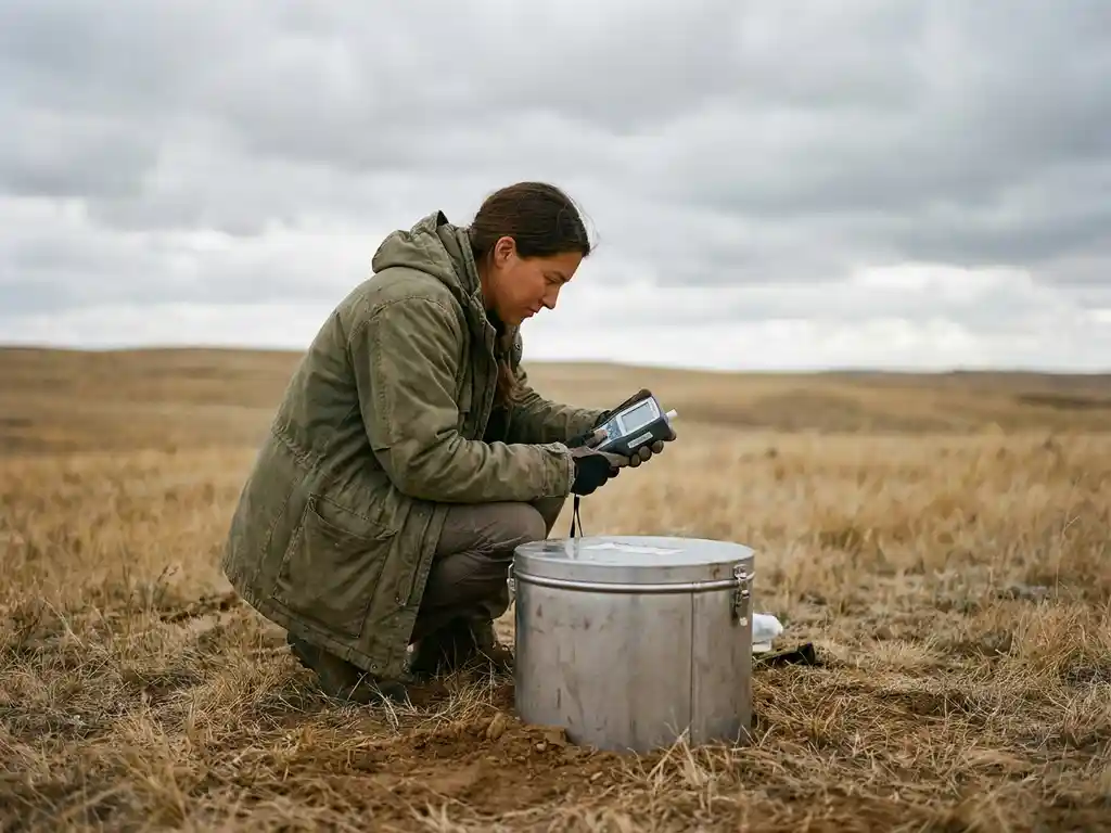
Scientists measure greenhouse gas emissions in the field using a combination of direct sampling instruments, automated flux systems, and remote sensing platforms. The choice of method depends on the scale of measurement needed, the specific gases being tracked, and whether researchers are monitoring a single source or an entire landscape. The sections below unpack the core techniques, from ground-level chambers to orbital satellites, and explain how the resulting data shape climate policy.
What tools do scientists use to measure greenhouse gases outdoors?
Scientists measuring greenhouse gas emissions in the field rely on a core toolkit that includes gas analyzers, flux chambers, eddy covariance towers, portable spectrometers, and drone-mounted sensors. These instruments detect concentrations of carbon dioxide, methane, nitrous oxide, and other climate-relevant gases directly in the atmosphere or at the soil and water surface, providing real-time or time-averaged data on emission rates.
The most widely used analyzers work on infrared absorption principles. Because each gas molecule absorbs infrared light at specific wavelengths, an instrument that shines a beam through an air sample can calculate gas concentration with high precision. Portable versions of these analyzers are now compact enough to carry into remote forests, wetlands, or agricultural fields, making carbon emissions monitoring feasible in locations that were previously inaccessible.
Complementing the analyzers are supporting instruments that measure wind speed, temperature, humidity, and atmospheric pressure. These meteorological variables are essential context because emission rates are rarely static. Warm, wet soil releases far more methane than the same soil frozen in winter, so field campaigns always pair gas measurements with environmental data to make the numbers interpretable.
Together, We Drive Innovation
Support global research, foster collaboration, and create a sustainable future.
How does the eddy covariance method work?
Eddy covariance is a field measurement technique that calculates the net exchange of greenhouse gases between an ecosystem and the atmosphere by simultaneously measuring vertical wind speed and gas concentration at high frequency, typically ten to twenty times per second. When air moves upward and carries more CO2 than the downward-moving air, the ecosystem is a net emitter; when the reverse is true, it is absorbing carbon.
A standard eddy covariance tower holds a three-dimensional sonic anemometer and a fast-response gas analyzer at a height that represents the surrounding landscape, often between two and forty meters depending on the vegetation. The system logs thousands of data points per minute, and researchers then apply statistical covariance calculations to extract the average flux over thirty-minute or hourly intervals.
One of the method’s greatest strengths is its spatial footprint. A single tower can integrate emissions from hundreds of hectares, capturing the mosaic of soil types, plant communities, and moisture conditions within a landscape. This makes eddy covariance particularly valuable for measuring greenhouse gas emissions across forests, grasslands, peatlands, and croplands at a scale that chamber-based methods cannot match. The global FLUXNET network connects hundreds of these towers, creating a continuous, long-term record of ecosystem carbon and water exchange that underpins much of what the scientific community knows about terrestrial carbon budgets.
What is a flux chamber and how is it used in the field?
A flux chamber is an enclosed container placed directly over a section of soil, water, or plant material to trap gases emitting from that surface. By measuring how gas concentration inside the chamber rises or falls over a known time period, scientists calculate the emission or uptake rate for that specific patch of ground. Flux chambers are the most direct and widely applicable tool for measuring greenhouse gas emissions at the point of origin.
Static versus dynamic chambers
Static chambers are sealed after placement and sampled manually with a syringe at set intervals, usually over thirty to sixty minutes. The collected air samples are later analyzed in a laboratory. This approach is low-cost and deployable almost anywhere, making it the dominant method for measuring nitrous oxide from agricultural soils and methane from rice paddies or wetlands.
Dynamic chambers, sometimes called flow-through chambers, continuously flush air through the enclosure while an analyzer measures the difference in gas concentration between the incoming and outgoing air streams. They produce near-continuous flux estimates and are better suited to environments where emissions fluctuate rapidly, such as actively decomposing compost or tidal mudflats.
Limitations researchers work around
The main limitation of any flux chamber is its small footprint, typically a fraction of a square meter. A single chamber reading may not represent the broader landscape, so field campaigns commonly deploy multiple chambers across a grid to capture spatial variability. Researchers also account for the fact that enclosing a surface can alter temperature and humidity inside the chamber, which may slightly modify the very emissions being measured. Careful chamber design and short deployment times minimize this disturbance.
How do satellites and aircraft measure greenhouse gas concentrations?
Satellites and aircraft measure atmospheric greenhouse gas concentrations by analyzing the spectrum of sunlight or thermal radiation passing through the atmosphere. Instruments called spectrometers detect how specific wavelengths are absorbed by gas molecules, allowing scientists to calculate column-averaged concentrations of CO2, methane, and other gases across large geographic areas without any ground-based equipment.
Dedicated satellite missions have transformed large-scale carbon emissions monitoring. Instruments such as those aboard the OCO-2 and OCO-3 satellites measure atmospheric CO2 with enough precision to detect regional-scale emissions from industrial zones, cities, and deforesting areas. Methane-focused satellites can now pinpoint individual super-emitting facilities, such as oil and gas infrastructure or large landfills, from orbit.
Aircraft campaigns offer a middle ground between the broad coverage of satellites and the precision of ground instruments. A research aircraft flying transects downwind of a city or industrial facility can construct a two-dimensional cross-section of the gas plume, and scientists integrate these measurements to estimate total emissions from the source below. This approach has been particularly useful for independently verifying emission reports from large industrial installations.
The main challenge for both platforms is that the atmosphere mixes gases continuously. Attributing a concentration signal measured from altitude back to a specific surface source requires sophisticated atmospheric transport models that simulate how winds carry and dilute emissions between the ground and the sensor. Improvements in these models, combined with denser satellite coverage, have significantly strengthened the reliability of top-down greenhouse gas measurement in recent years.
Why do field measurements sometimes differ from emissions inventories?
Field measurements of greenhouse gas emissions often differ from national or sectoral emissions inventories because inventories are calculated using activity data and emission factors rather than direct observation. An inventory might estimate agricultural methane by multiplying livestock numbers by a standard emission factor, while a field campaign measuring actual animal respiration and manure emissions may find the real-world rate is higher or lower than the factor assumes.
Several specific sources of divergence are well-documented in the climate science literature. Inventory emission factors are typically derived from a limited set of studies conducted under specific conditions, and those conditions may not match the climate, soil type, or management practices in the region being inventoried. Biological processes driving methane and nitrous oxide emissions are also highly sensitive to temperature and moisture, meaning a year with unusual rainfall can push actual emissions well outside the inventory estimate even if the underlying activity data are accurate.
Measurement scale also matters. A flux chamber captures emissions from a patch of soil; an inventory covers an entire country. Spatial heterogeneity, the natural variation in emission rates across a landscape, means that scaling up from a small number of measurement sites introduces uncertainty. Researchers address this by combining multiple field measurement techniques, increasing the number of sampling locations, and using geostatistical methods to interpolate between measurement points more reliably.
Rather than treating these discrepancies as errors, the scientific community treats them as information. When field measurements consistently show higher emissions than an inventory in a particular sector, it signals that the emission factors used in that sector need revision. This iterative process of measurement, comparison, and refinement is how national greenhouse gas accounting systems improve over time.
How are field measurement data used to inform climate policy?
Field measurement data inform climate policy by providing independent, evidence-based estimates of greenhouse gas emissions that governments and international bodies use to verify national commitments, identify the largest emission sources, and evaluate whether mitigation measures are actually reducing emissions. Without field data, policy would rest entirely on self-reported inventory figures that are difficult to cross-check.
At the international level, data from ground-based monitoring networks and satellite missions feed into global assessments produced by bodies such as the Intergovernmental Panel on Climate Change. These assessments synthesize field measurement findings to produce the emission budgets and warming projections that anchor international climate agreements. When field data show that a particular source category, such as tropical wetlands or permafrost thaw, is contributing more to atmospheric methane than previously estimated, that finding can shift the priorities of both research funding and mitigation policy.
At the national and subnational level, field campaigns serve a verification function. A government that has implemented a policy to reduce emissions from its agricultural sector can commission field measurement studies to assess whether soil nitrous oxide or livestock methane has actually declined. This evidence base strengthens accountability and helps policymakers distinguish between policies that are working and those that need adjustment.
Field data also support carbon markets and nature-based solutions. Voluntary carbon offset projects, such as reforestation or improved wetland management, increasingly require direct measurement rather than modeled estimates to issue credible carbon credits. Eddy covariance towers and chamber networks deployed in these project areas generate the continuous, auditable flux records that buyers and standard-setting bodies require before recognizing a project’s claimed removals.
How WAITRO supports greenhouse gas emissions research and climate action
Advancing the quality and reach of greenhouse gas emissions measurement requires more than instruments and field teams. It demands institutional capacity, cross-border collaboration, and the ability to translate scientific findings into actionable policy. This is precisely where we contribute.
Through our global network of research and technology organizations, we help members strengthen the capabilities needed to conduct, scale, and apply field measurement science. Concretely, we support this work by:
- Building institutional capacity in research organizations so they can deploy and maintain field measurement infrastructure, train technical staff, and produce data that meets international quality standards
- Facilitating cross-border partnerships that connect research teams in data-rich regions with counterparts in areas where field measurement coverage is sparse, closing critical gaps in the global emissions monitoring picture
- Supporting innovation ecosystems that bring together government agencies, NGOs, and research institutions to co-design monitoring programs aligned with national climate commitments and the UN Sustainable Development Goals
- Providing pathways to impact by helping members translate field measurement findings into evidence that informs policy decisions at national and international levels
If your organization is working to strengthen climate science capabilities, verify emissions reductions, or build the partnerships needed to turn field data into policy action, we invite you to connect with us and explore how WAITRO membership can amplify your impact.
Related Articles
- What is climate research and why does it matter in 2026?
- How does climate innovation differ from traditional sustainability efforts?
- How can early-career scientists break into climate research today?
- How Do Developing Countries Build Research Capacity?
- What Is the Difference Between an RTO and a University?
